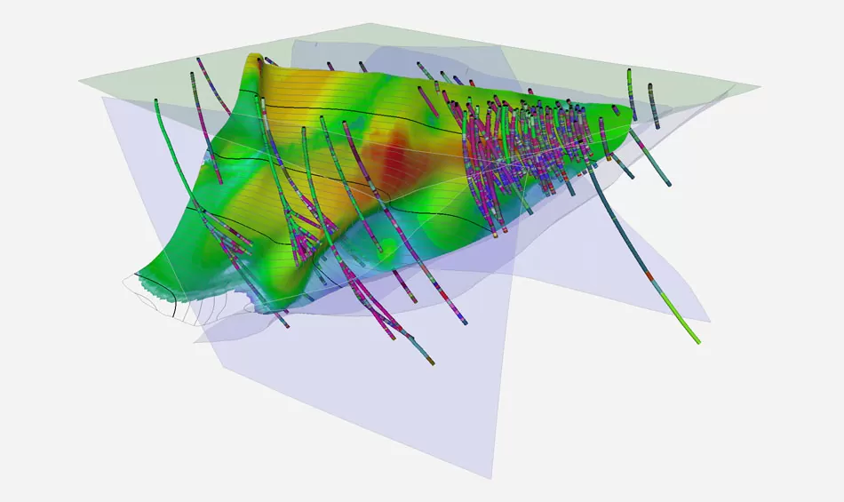
Geological Modelling & Resource Software Specifications
The figures below describe typical industry specifications for this class of equipment rather than a single fixed model. Use them to scope a requirement, then confirm exact figures against the supplied unit before purchase.
| Specification | Typical value |
|---|---|
| Drillhole database | Collar, survey, assay and lithology tables with validation |
| Data validation | Overlap, gap, out-of-range and survey deviation checks |
| Compositing | Fixed length or geology-honouring downhole composites |
| Statistical tools | Histograms, probability plots, top-cut analysis, variography |
| Wireframing | Explicit sectional or implicit modelling from grade shells |
| Block model | Regular or sub-blocked, rotated to the orebody orientation |
| Interpolation methods | Ordinary kriging, inverse distance, nearest neighbour |
| Classification | Measured, Indicated and Inferred by search and confidence criteria |
| Validation | Swath plots, visual section checks, comparison against composites |
| Reporting | Grade-tonnage curves and JORC or NI 43-101 tables |
| Deployment | Desktop workstation; some cloud-collaborative options |
| Interoperability | DXF, CSV, ODBC and common mine planning formats |
What a Geological Modelling & Resource Software Is Used For
- Drillhole database management and validation
- Mineralisation wireframing and domaining
- Block model construction and grade estimation
- Mineral resource classification and reporting
- Pit optimisation and mine planning input
Maintenance Schedule
Most premature failures in this equipment class trace back to a missed routine check rather than a design fault. The intervals below are a practical starting schedule; adjust them to your duty cycle and the manufacturer manual.
| Interval | Task |
|---|---|
| On every data load | Run the full validation suite before modelling; unvalidated assay data is the origin of most resource errors. |
| Weekly | Back up the drillhole database and model files with versioning, not overwriting. |
| Per estimate | Document every parameter (search ellipse, top cut, density, composite length) so the estimate is reproducible and auditable. |
| Annually | Reconcile the model against actual mined tonnes and grade; persistent bias means the estimation parameters need revisiting. |
Frequently Asked Questions
What software is used for resource estimation?
The commercial mainstays are Datamine, Micromine, Surpac, Vulcan and Leapfrog, with the open-source ecosystem around Python and GSLIB used for specialised geostatistics. Choice matters less than the competence of the estimator. All of these tools will faithfully produce a wrong answer from bad parameters.
Do I need software to report a JORC resource?
Practically, yes. A JORC-compliant estimate requires documented, reproducible methodology with validation, and that is not achievable in a spreadsheet for anything beyond a trivial deposit. The Competent Person signing the statement will expect a defensible modelling workflow.
What is a block model?
A three-dimensional grid of cells covering the deposit, each carrying estimated grade, density, rock type and classification. It is the numerical representation used for reporting resources and for scheduling what gets mined and when.
What causes resource estimates to be wrong most often?
Bad input data and unexamined assumptions, not the interpolation algorithm. Unvalidated assays, missing or wrong downhole surveys, inappropriate top-cutting of high grades, and density assumed rather than measured account for most large reconciliation failures.
Supply and Delivery Across Tanzania
Bart Mining supplies geological modelling & resource software and related equipment to mining operations throughout Tanzania, with primary coverage of the Lake Victoria Goldfields (Mwanza, Kahama, Geita, Shinyanga and Bukombe), alongside the Lupa Goldfields around Chunya and Mbeya, and delivery nationwide from Dar es Salaam.
Request a quotation
Need a geological modelling & resource software specified for your site?
Tell us your duty, depth or throughput and available power supply. We will come back with a specification and price, and flag anything on site that needs to change to make it work.